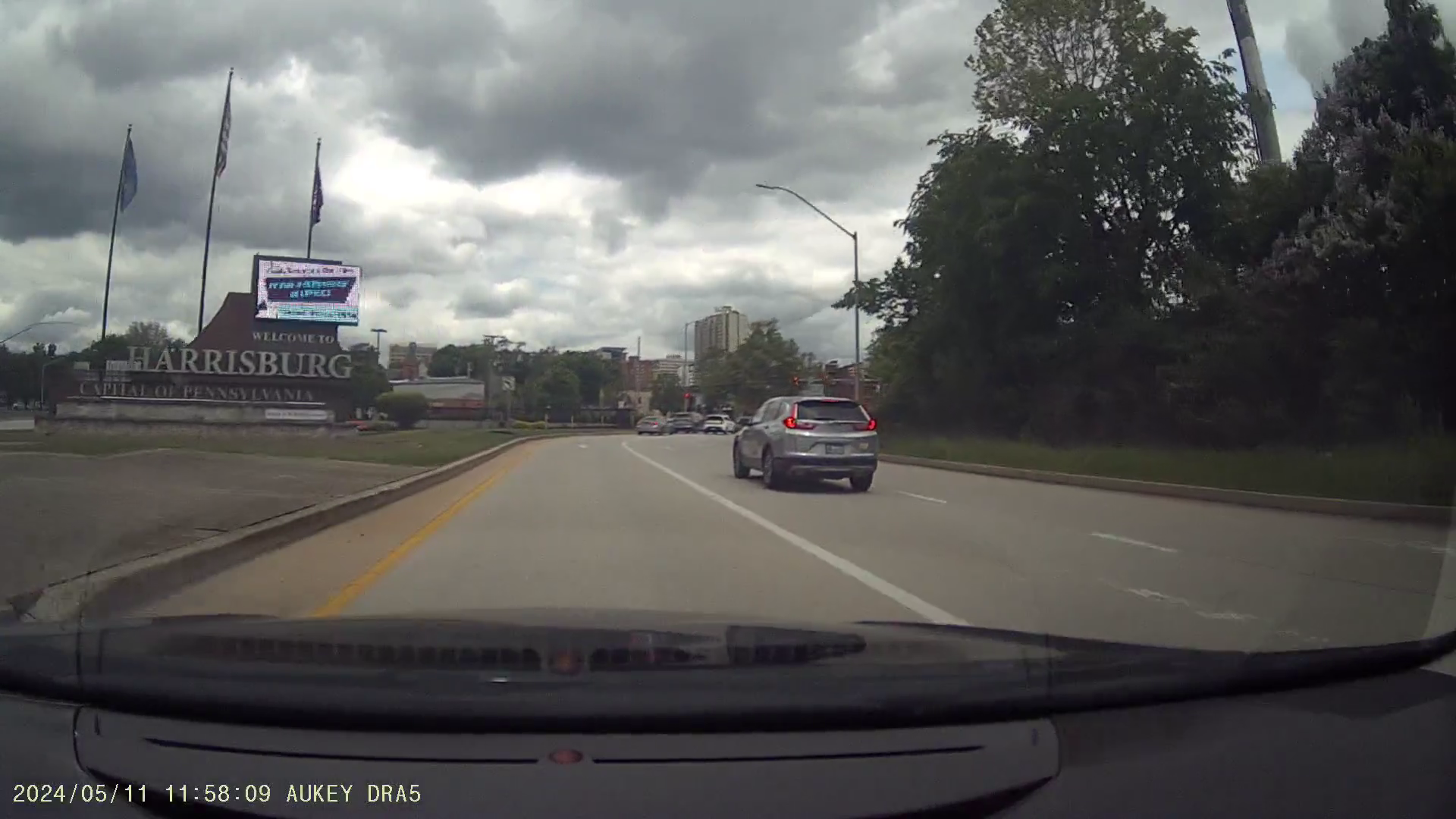
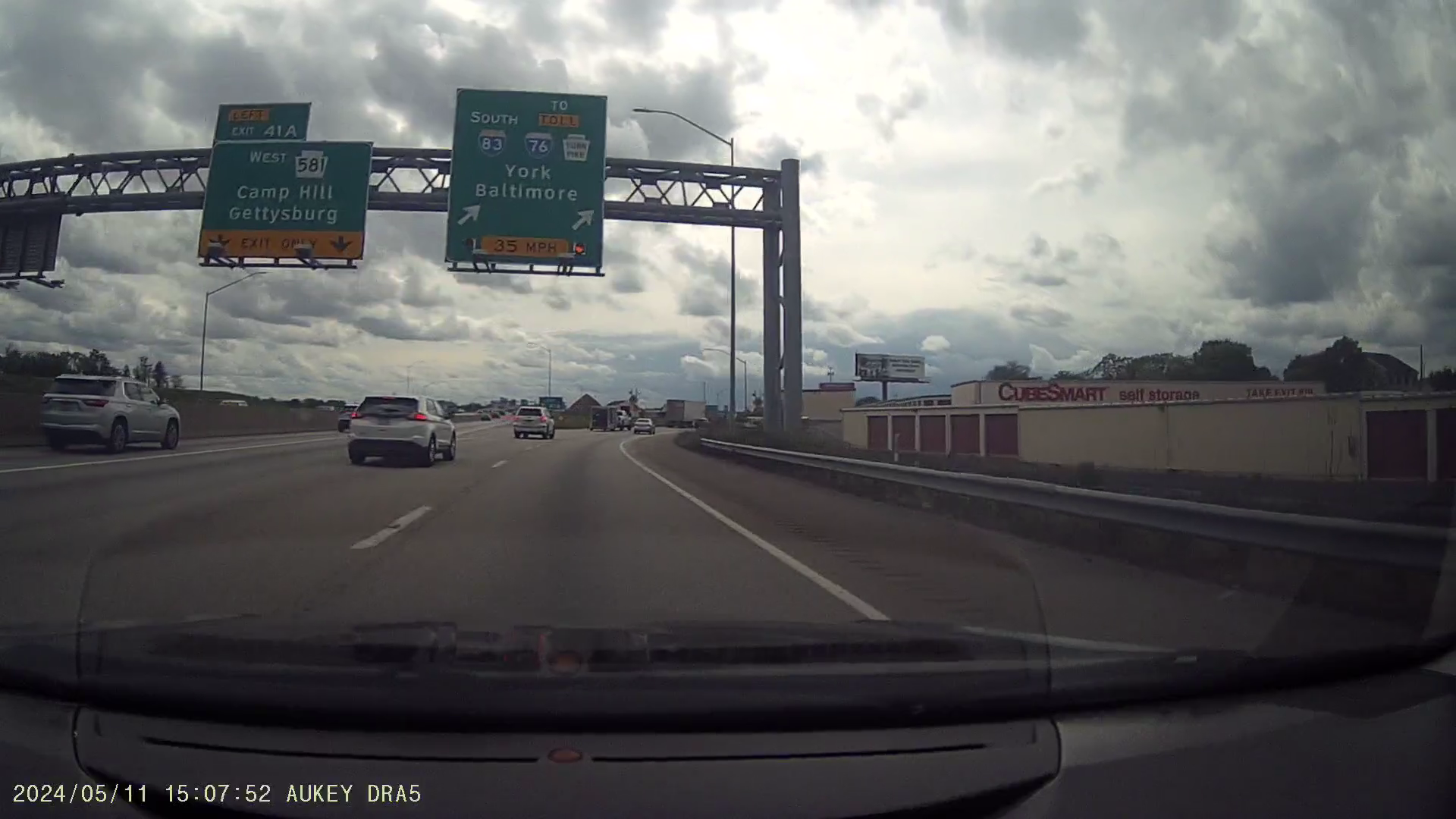
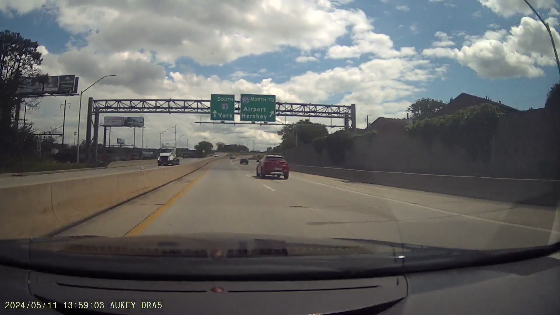
Entering Harrisburg from I-83's exit to 2nd Street. I believe the median right here would have held the cancelled East Shore Expressway, discussed later in this article. Footage from my dashcam.
Harrisburg, Pennsylvania, the state capital, has a somewhat unusual highway system, especially for a relatively small city. Harrisburg has a population of just over 50,000, peaking at just under 90,000 in 1950. Its metropolitan area is home to just under 600,000, making it the 95th most populated in the United States.
Combining the area with nearby metropolitan regions, it has a population of about 1.75 million, covering an area of 3,913 square miles. This is comparable to the Hampton Roads metropolitan area in southeastern Virginia, which is home to 1.8 million people over 3,729 square miles, though much of that area is water.
| Metro Area | Population | Area (sq mi) | Core City | Population | Peak Population |
|---|---|---|---|---|---|
| Harrisburg-Carlisle | 591,712 | 1,656 | Harrisburg | 50,099 | 89,544 (1950) |
| Lancaster | 558,589 | 984 | Lancaster | 58,039 | 63,774 (1950) |
| York-Hanover | 456,438 | 911 | York | 44,800 | 59,953 (1950) |
| Lebanon | 143,257 | 362 | Lebanon | 26,814 | 30,045 (1960) |
| Total | 1,749,996 | 3,913 | Total | 179,752 | 243,316 |
The Harrisburg area has always been traversed by several major highways, making the area a crossroads for long-distance travelers, especially since these roads enter and leave the area in every possible direction. Major routes are listed below.
| Direction | Route | Pennsylvania Destinations | Out-of-State Destinations |
|---|---|---|---|
| Northwest | US-22/US-322 | Altoona, State College, Erie | Cleveland |
| North | US-11/US-15 | Selinsgrove, Williamsport | Rochester, Buffalo |
| Northeast | I-81, US-22 (to I-78) | Hazleton, Scranton, Allentown | Syracuse, New York City |
| East | US-322, US-422 | Hershey, West Chester | South Jersey |
| East | PA Turnpike (I-76) | Reading, Philadelphia | Atlantic City |
| Southeast | PA-283 | Lancaster | Delaware (via other routes) |
| South | I-83 | York | Baltimore |
| South | US-15 | Gettysburg | Frederick, Washington |
| Southwest | I-81, US-11 | Carlisle, Chambersburg | Hagerstown, Roanoke, Knoxville |
| West | PA Turnpike (I-76) | Somerset, Pittsburgh | Wheeling, Columbus, Akron |
Several of these highways feature at least controlled access, meaning they are designed for high-speed, long-distance travel. The primary freeways in the area include the Pennsylvania Turnpike (I-76), I-283/PA-283, and the highways which form Pennsylvania's Capital Beltway: I-81, I-83, and PA-581. I-283/PA-283 spurs from I-83 to the southeast, while the Pennsylvania Turnpike (I-76) passes to the south of Harrisburg, with only a few interchanges in the area, linking with the most important highways.
This article primarily focuses on the area within the Pennsylvania Capital Beltway, particularly the area immediately surrounding Downtown Harrisburg, focusing on the West Shore Expressway and East Shore Expressway.
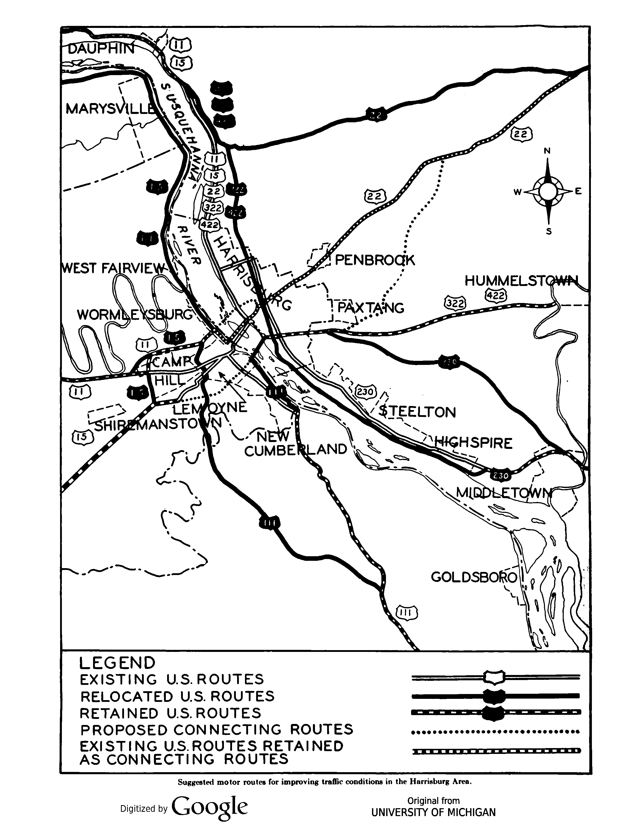
The West Shore Expressway is the more well-known of Harrisburg's proposed highway network, as sbeaver44 posted a 1970 planning map for East Pennsboro Township on the AARoads Forum, which showed much of the proposed route of the highway.
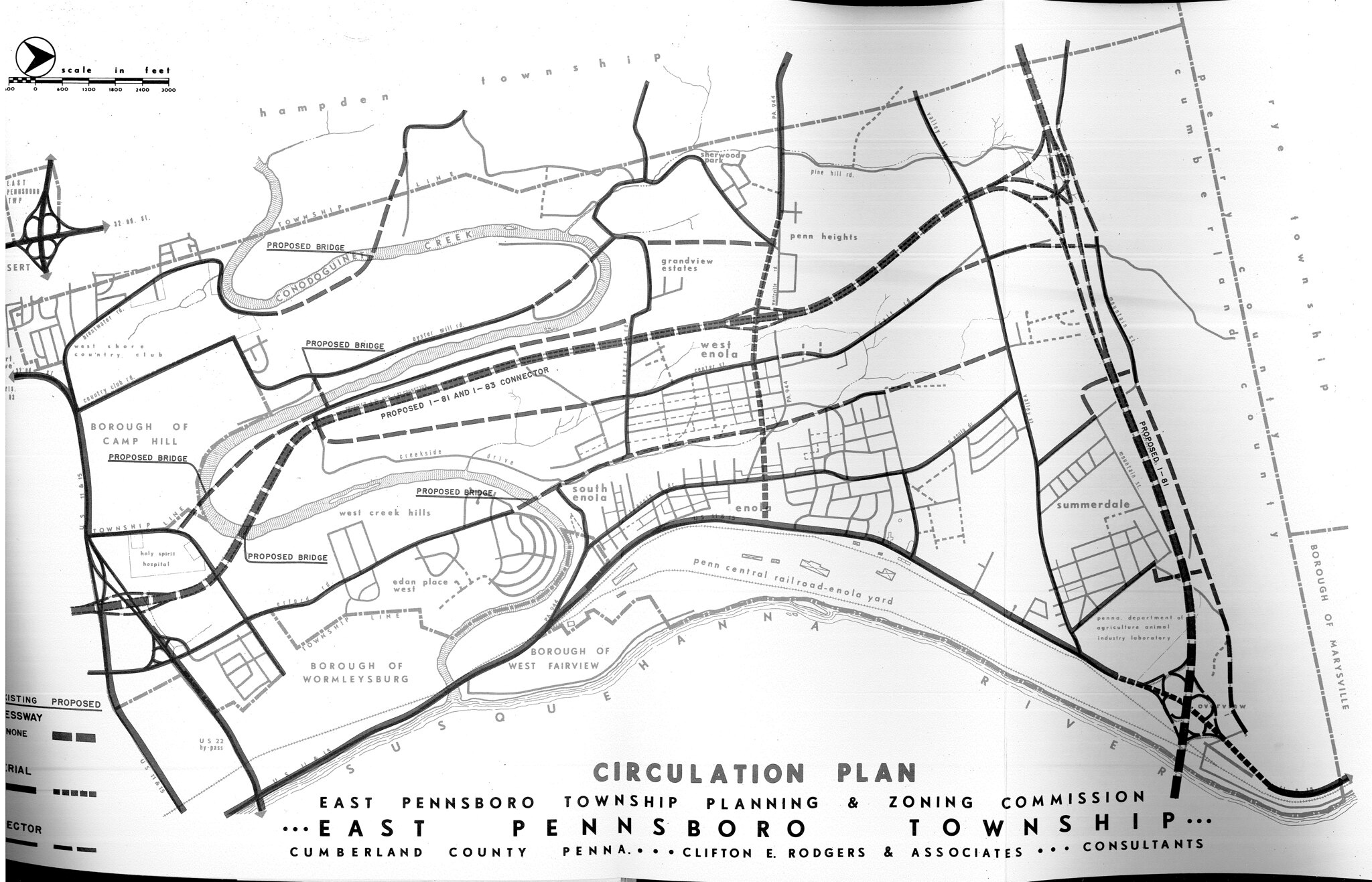
Additional searching through scanned Pennsylvania Department of Transportation (PennDOT) records on the Pennsylvania State Archives website shows additional plans for the highway, particularly beyond the reaches of the township, along with some extra details on its routing.
These documents suggest the following about the West Shore Expressway:
The I-83/PA-581 interchange is a classic example of the shortcomings involved in 1950s highway design. Its original design was a fusion of a trumpet interchange between these two highways, combined with a heavily modified partial cloverleaf providing local access to Lemoyne and New Cumberland.
That said, the I-83/PA-581 interchange was redesigned slightly in the 2000s, correcting one of the major issues, as I-83 traffic had to merge in with PA-581 traffic, with only one lane.
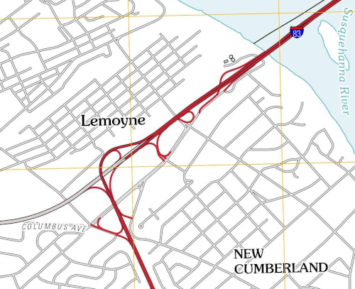
The 1970 East Pennsboro Township plans show a diamond interchange with US-11/US-15 and the M. Harvey Taylor Bridge connector, approximately where the two roads split. The M. Harvey Taylor Bridge is an oddity on its own, as its connector feels like a freeway wanting to connect to another freeway. I've wondered if the West Shore Expressway was meant to be that other freeway.
This isn't as notable as the other segments, but it does explain the very wide median on I-81 in that area.
The suggested designation of US-15 for the West Shore Expressway is found in the October 23, 1968 minutes of the State Transportation Commission. This certainly would make for a very complicated route for US-15 had it been implemented. If my assumptions are correct, traffic following US-15 would have to merge into today's PA-581, then follow the West Shore Expressway, merge onto I-81, then merge into today's US-11/US-15.
That said, there is a note in that same document. "Secretary Bartlett stated the Department has submitted this project to the Federal Bureau of Public Roads for inclusion in the Interstate Program." Given that, and the many oddities of I-83's routing east of the Susquehanna River, I wonder if the West Shore Expressway was planned to be I-83, instead of today's highway.
If I had to guess, had the West Shore Expressway been built as part of the Interstate highway system, these changes would be made:
| New Route |
Current Route(s) |
Notes |
|---|---|---|
| I-83 | West Shore Expressway (cancelled) |
(none) |
| I-581 | I-283 | This proposal “orphans” I-283 from its parent route, so I-581 is used, as it would connect to another x81. |
| I-681 | PA-581, I-83 north of PA-581 |
Uses an even starting digit, as it connects to its parent route at its western and eastern termini. |
This would eliminate the awkward routing that I-83 follows today, allowing that interstate to bypass Downtown Harrisburg, with a new spur route (I-681) directly serving the city.
According to the Tri-County Regional Planning Commission's recommendations for highway improvements for the PennDOT six-year program from 1968, both the West Shore Expressway and PA-581 were shown.
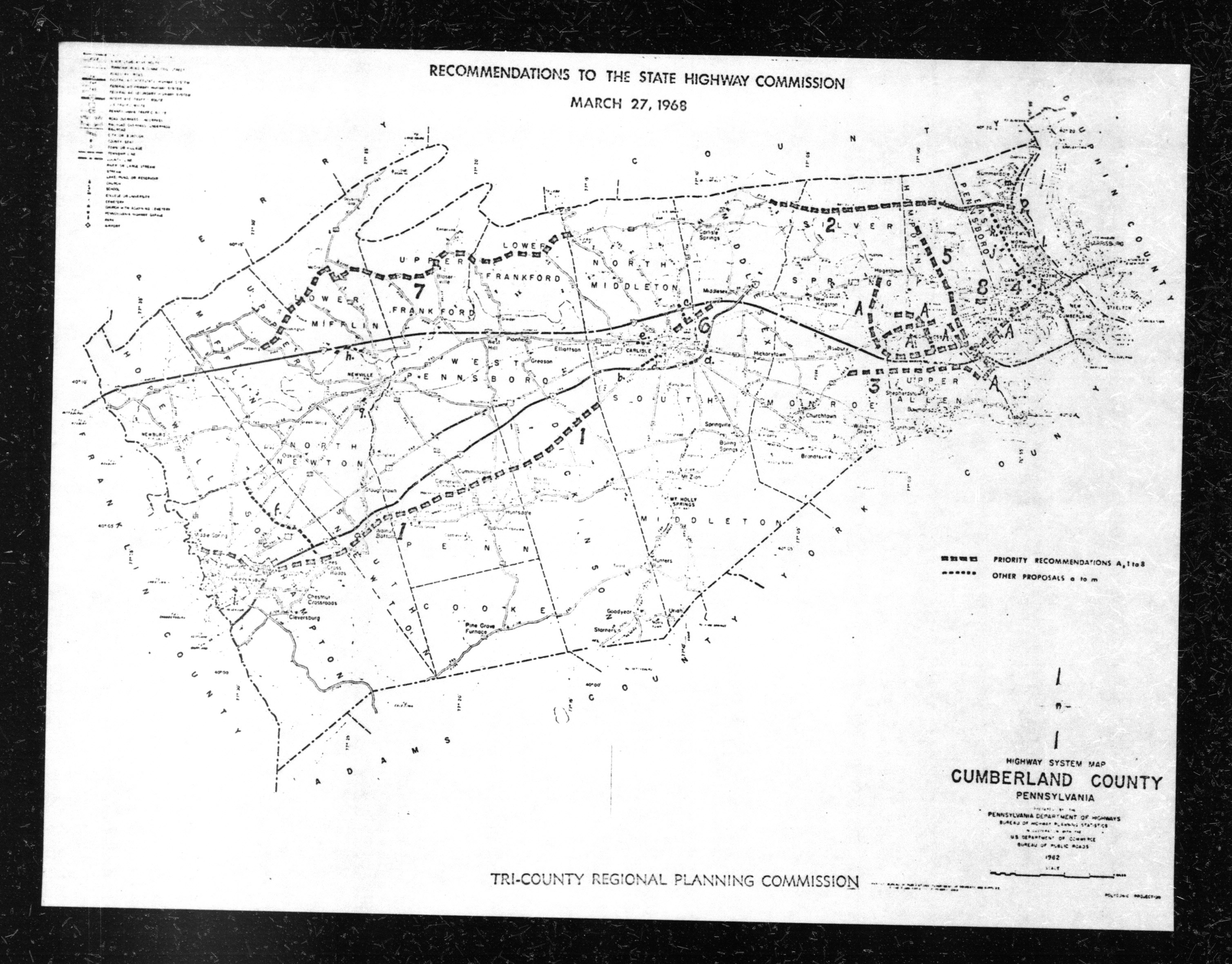
There are two notable statements in these highway recommendations. First, there was a "Special Note" for Cumberland County, indicating the importance of the West Shore Expressway:
"Certain highway improvements, suggested for inclusion on the priority listing, are closely related to the proposed West Shore Expressway.
The Cumberland County Planning Commission is awaiting the results of an analysis, by the Highway Department, of origin and destination survey data, upon which it expects to base its decision for the Expressway or for some alternative improvement.
The establishment of the priorities of the other related improvements, it is felt, should be deferred until the major question is settled."
The second description appears to be a description of PA-581. Note that it is described as a "spur of I-81," suggesting it could have been considered for the Interstate highway system:
"5. The spur of I-81 (L.R. 1067-1) to the intersection of Route 11 and the Harrisburg Expressway in Hampden Township and an extension to U.S. 15 in the southwestern portion of Lower Allen Township, with appropriate interchanges to be studied at all existing highways (5.2 miles)."
There are two interchanges in the Harrisburg area that hint at the ambitious highway plans of the 1960s. Those include the I-83/2nd Street interchange in Downtown Harrisburg and the four-level stack interchange between I-81 and US-22/322, north of Harrisburg.
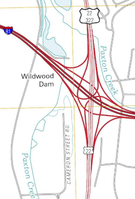
The I-83 interchange may not pique immediate interest, but the I-81 interchange does. While the stack interchange is fully in use, the movement from I-81 to US-22/US-322 West connects to a high-speed controlled access highway, while the movement from I-81 to US-22 East connects to an awkwardly placed four-lane divided highway, in an area that's an odd mix of industrial and residential.
This movement was meant to serve the East Shore Expressway, one of the most elusive highways I've tried to research. While several scanned transportation documents available online mention the East Shore Expressway, often by other names, I've only been able to find one scanned map showing the proposed route, and it's of very poor quality!
Alternative names I've found include the Downtown Lifeline, Harrisburg Lifeline, and the River Relief Route.
Based on the numerous documents I've read about this subject, I believe the Downtown/Harrisburg Lifeline refers to the East Shore Expressway, while the River Relief Route refers to US-22/US-322 north of I-81.
I've also seen references to the Cameron Street Extension, but the route description I found, shown in the next section, suggests that Cameron Street serves a completely different route from the East Shore Expressway.
The earliest mention of a road roughly in this corridor is in Harrisburg's city plan from 1940, describing an alternate route for US-322 and US-422:
"U.S. 322 (CLEVELAND-STATE COLLEGE-HARRISBURG-ATLANTIC CITY) and U.S. 422 (CLEVELAND-YOUNGSTOWN-HARRISBURG-READING-PHILADELPHIA)
It has been proposed that traffic on these routes, (which coincide through the Harrisburg Area), together with the north and south traffic flow to and from U.S. 230 should avoid the congested area of the City by using an elevated highway to be constructed over Paxton Creek for the two-mile stretch from Paxton St. to Maclay St. and from thence northward by a new surface-level road between the railroad and Wildwood Park, (designated as the Parkside Bypass), or near the edge of the bluff along the east side of the park, to a cloverleaf intersection with rerouted U.S. 22, just east of the proposed viaduct over the railroad near Rockville. U.S. 322 would overpass the present Linglestown Road before joining U.S. 22.
[...]
Considerable right-of-way would be needed beyond the present 28-30 ft. width, in order to provide divided twin traffic lanes on an elevated structure. It is possible, however, that if the structure were cantilevered out, only easements, rather than actual purchase of additional width, might be sufficient. Between Market and Mulberry Sts. reconstruction of the rear ends of some buildings would be necessary where they would interfere with the full width of the elevated structure."
A map of this proposed route is shown below.
As this document dates to 1940, it has an interesting note about how this highway "would permit trucks and cars, at a speed of say 40 miles per hour, to travel the two miles in three minutes." Note that today's freeways immediately around Harrisburg have a 55 mile per hour speed limit.
Later in the document, recommendations are made to preserve the right-of-way for the proposed highway, suggesting a strong desire to construct this highway:
"Concerning New or Rerouted Motorways in the Harrisburg Area It Is Recommended:
[...]
34. That the Harrisburg City Council and City Planning Commission takes steps to promote continuation by the State Department of Highways of a new route from Maclay St., east of the railroad to an intersection with proposed new U.S. 22 at or beyond the present Linglestown Road.
35. That the Harrisburg City Council take steps to protect from further interim private development the route of the proposed Paxton Creek Elevated expressway, by establishing therefor on the official city map a right-of-way not less than 80 feet wide."
The only other detailed city or regional plan I could find for the Harrisburg area from 1940 to 1968 was the 1960 Master Plan from the Regional Planning Commission of Greater Harrisburg. While this document describes the River Relief Route, it makes no mention of an East Shore Expressway around Downtown Harrisburg.
The Pennsylvania State Archives PennDOT document collection, among those available online, has a scanned map of highway plans in Dauphin County as of 1968, as part of the Tri-County Regional Planning Commission's recommendations for highway improvements for the PennDOT six-year program. This map does feature the East Shore Expressway, but it's hard to make out.
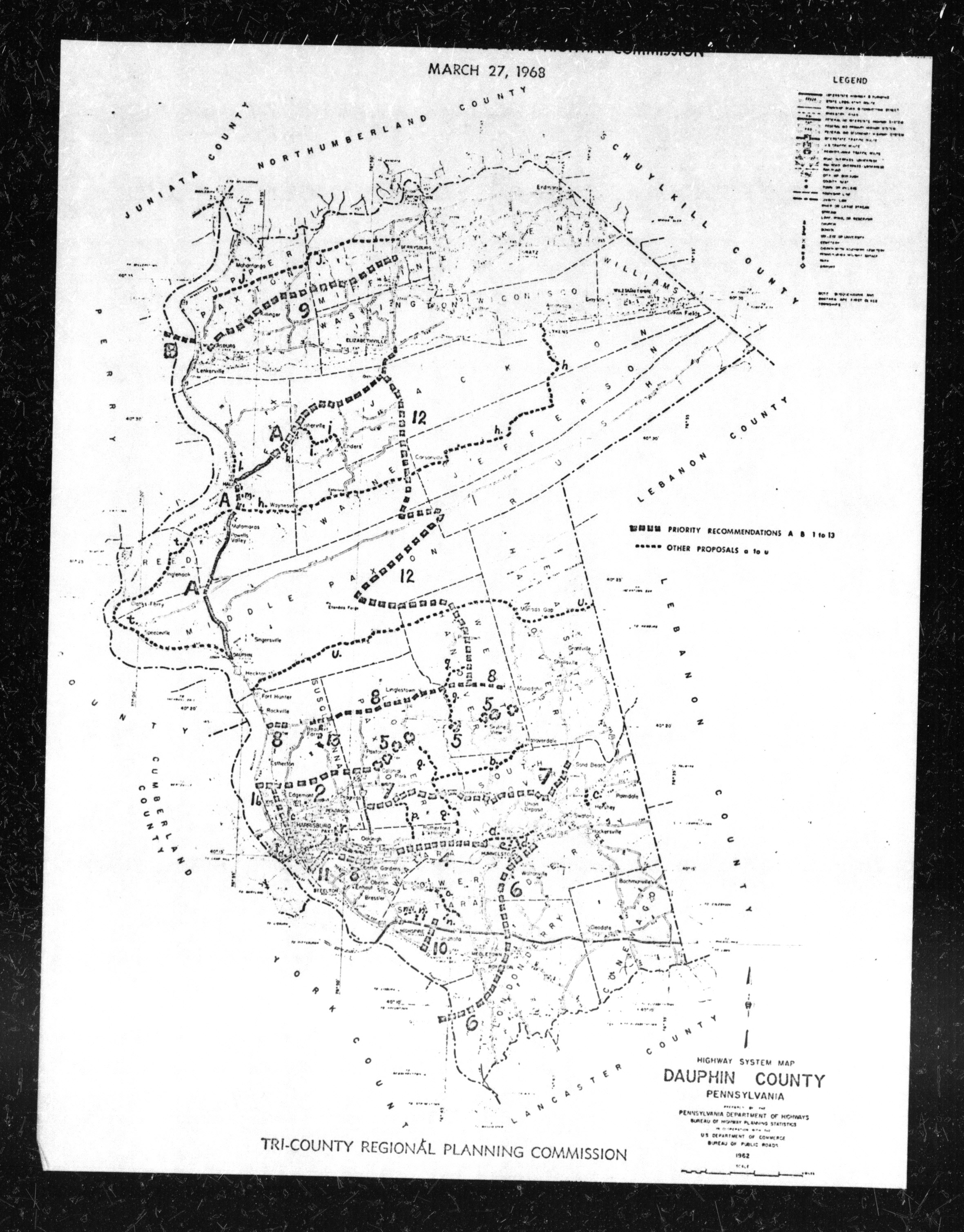
Thankfully, the plans are detailed in the supporting documentation, giving a clearer idea as to the planned route:
"1. In Harrisburg, in three sections, construct a multi-lane limited access connection from I-83, 2nd Street Interchange, to the interchange of I-81 and the Cameron Street Extension.
Section A runs north from the 2nd Street Interchange of I-83, generally via Mulberry Street and the Penn-Central Station Area, over Market Street, to the vicinity of Fisher Plaza to serve the State Capitol (1.2 miles)
Section B runs, as an extension of Division Street, east from 7th and Division Streets, under the Penn-Central Railroad to an intersection with the Cameron Street Extension (thence north to I-81) (0.7 mile).
Section C runs north from the Fisher Plaza area to Division Street extended (1.4 mile), with connections to the Farm Show area.
2. Partially relocate and reconstruct Elmerton Avenue (L.R. 22054) as a spur from the interchange of Division Street and Cameron Street extension (Section C of 1. above) east to the intersection of Colonial Road and U.S. 22, (3.0 miles)."
This helps give a good idea as to where the highway would have run, though it is unclear if it would run to the west or east of the railroad. My understanding is that it would run west of the railroad, for the most part, until it reached Division Street, 2.6 miles from its southern terminus.
All that said, I'm not sure what route number the East Shore Expressway would take. If I had to guess, probably US-322, as it currently multiplexes with I-81 and I-83 to reach the Eisenhower interchange (I-83/I-283/US-322). Based on my assumptions, then US-22/US-322 would follow this new routing:
That said, one concern often discussed in highway planning, especially related to the plans in urban areas made during this time, is the construction of highways through residential areas and the resulting impacts. While much of this area seems to have been industrial for a long time, running right against the railroad, at least some encroachment into nearby residential areas was likely possible and therefore controversial.
The highway was listed in the Harrisburg Area Transportation Study's 1974 Annual Report but was dropped by the 1975 Annual Report.
Links were active at the publication of this article on January 31, 2025.